Public comment is being accepted on the final version of a plan to eliminate cross-country, motorized travel in the last three areas of the Ketchum Ranger District where it has still been permitted.
A final environmental assessment, released last week, supports the district's proposal to limit motorized travel in the Greenhorn, Deer Creek and Cove Creek drainages to designated trails there. Those would include 146 miles of single track, 50 miles of ATV trails and 29 miles of jeep trails. Cross-country snowmobile travel would still be permitted.
The planning process began in 2004 following a directive from U.S. Forest Service Chief Dale Bosworth for national forest managers to get a handle on cross-country travel. Ketchum District Ranger Kurt Nelson said cross-country travel had already been prohibited on most of the Ketchum district, but that new, user-made roads were still appearing in some areas, especially during hunting season.
"What this does is say, 'Hey, enough of this nonsense,'" Nelson said.
Comments on the proposal were initially collected from 222 parties in the fall of 2006. The current comment period is open until Nov. 30. Joe Miczulski, Ketchum district recreation programs manager, called it a "courtesy comment period," since proposals that don't require a more stringent Environmental Impact Statement generally accept comments only at the initial stage.
"Our intention is not to change the final EA unless there is a gross error or a significant issue that we did not address in the draft EA," Miczulski said.
Nelson will make a decision on the plan following the comment period. The same process is underway in the Sawtooth National Forest's Fairfield and Minidoka districts. The U.S. Bureau of Land Management is also developing a travel plan for the land it manages in the southern part of Blaine County.
The EA for the Ketchum District includes three alternatives to current management; one would designate more trails for motorized use than the proposed alternative does and the other would designate fewer.
In Greenhorn Gulch, the proposal would add an existing motorized route between Cow Creek and Mahoney Ridge to the official trail system. It would also connect Alturas Gulch to the Cow Creek-Greenhorn system through construction of a three-mile-long trail. The currently closed Sawmill Creek Trail would be opened for non-motorized use.
The plan would designate a system of single-track trails from Cove Creek to the Indian Creek, Quigley Creek and Baugh Creek roads. Some of those trails would require coordination with and approval from the BLM.
Areas prioritized to provide motorized use in the near future include the Wolftone-Kinsey Creek loop and a system of trails in the South Fork of Warm Springs Creek, Middle Fork of Warm Springs Creek and Meadow Creek areas south along the Smoky Mountain crest to the head of Frys Gulch.
Under the plan, motorized camping would be allowed within 300 feet of designated roads. Hunters would be prohibited from using motor vehicles to retrieve big game shot off of designated routes.
A summary of the EA can be found on the Sawtooth National Forest's Web site under "Projects and Plans."


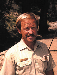 Kurt Nelson


